
info@topmarineeng.com
|
大直径长引水隧洞水下检测系统 / Underwater Detection System of Large Diameter

产品简介
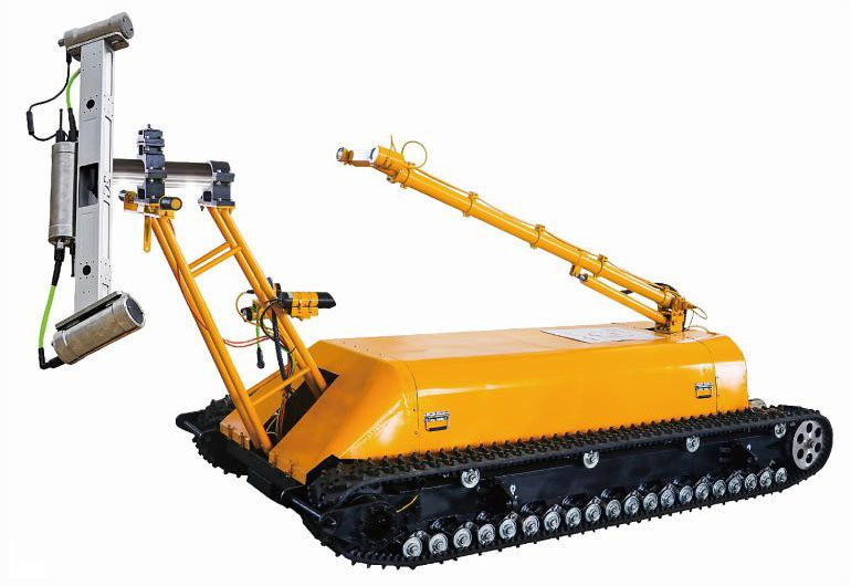
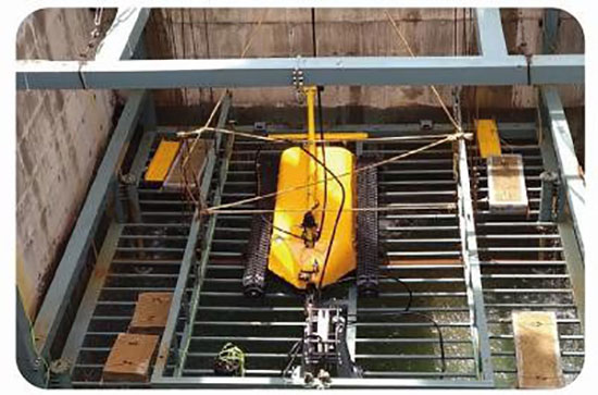
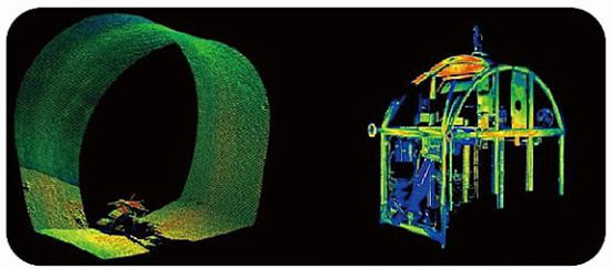
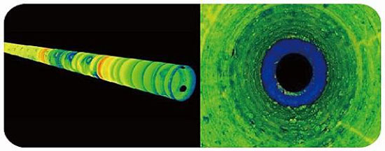
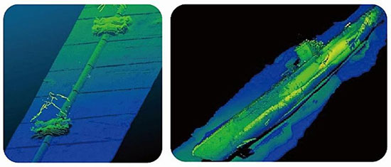
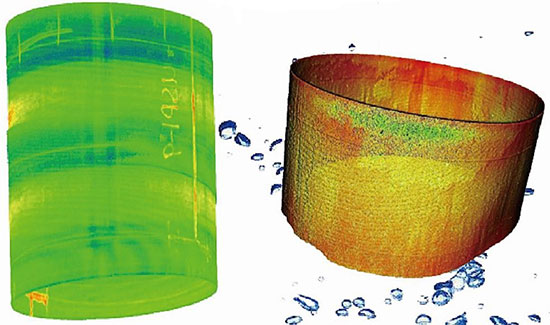
设计概述 大直径长引水隧洞水下检测系统实现取水隧洞运行有水流工况下的海生物生长监测、淤泥沉沙聚集监测及隧洞内的其余环境参数监测,获取隧洞内部的海生物生长清况分布、生长量评估,为后续隧洞的维护、隧洞的清理、海生物的防护等提供基础数据和决策依据。 另外可对水下建筑及矿洞架构进行三维扫描检测,可搭载不同的检测设备实施作业,适用于水下建筑物、大坝管道桥梁码头等局部地区的损坏情况进行图像扫描分析,其最大优点是在不影响施工位置正常作业的情况下对其进行检测。 通过扫描仪的旋转扫描可得到扫描区域的点云图,后期经过处理软件可将点云图数据转变为 三维视图航测实时生成三维点云数据,高密度点云数据便于识别微小特征、结构缺陷和精细 测量,可应用于长距离测线快速数据采集。 Design Overview The underwater detection system of large-diameter and long diversion tunnel can monitor the growth of marine organisms, sediment accumulation and other environmental parameters in the tunnel during the operation of the water intake tunnel, and obtain the distribution and growth assessment of marine organisms in the tunnel, so as to provide basic data and decision-making basis for subsequent tunnel maintenance, tunnel cleaning and marine biological protection. In addition, it can carry out three-dimensional scanning detection for underwater buildings and mine cave structures, and carry different detection equipment to carry out operation. It is suitable for image scanning and analysis of the damage of underwater buildings, dams, pipelines, bridges and wharves. Its greatest advantage is that it can be detected without affecting the normal operation of the construction position. The point cloud image of the scanning area can be obtained through the rotation scanning of the scanner. After the processing software, the point cloud image data can be transformed into three-dimensional view, and the three-dimensional point cloud data can be generated in real-time. The high-density point cloud data is easy to identify micro features, structural defects and fine measurement, and can be used for rapid data acquisition of long-distance survey lines.
应用场景 Application scenarios 中广核核电隧洞监测 Tunnel monitoring of CGN nuclear power plant
海底设备结构检测 Structural inspection of submarine equipment
管线外部内部完好性检测 External and internal integrity inspection of pipeline
其他应用扫描图像 Other applications scan images
输油管线检测 Oil pipeline inspection 海底救捞 Sea Bottom salvage
海底古建筑勘测 Marine Ancient Architecture Survey 防洪墙检测 Detection of flood wall 突破短板
Break through the short board
管网扫描检测 Pipeline scanning detection
产品参数
技术参数 尺寸重量:机器人 3750*1650mmx1700mm, 2200Kg (水中); 动力系统:整体液压驱动系统; 作业能力:作业深度习≥100m, 速度 40m/min, 抗水流能力>3m/s, 爬坡能力 30°, 水下牵引力≥800kg; 观测系统:200 万微光全彩高清网络模组,低照度:0.001Lux@F1.2 彩色模式;0.005Lux@F1.2黑白模式; 3D 扫描:扫描范围 1.5-20m 覆盖角度 50°, 分辨率: 0.2mm@3m—7.1mm@20m, 深度仪: 量程: 0-100m, 精度等级: 0.1%FS, 响应:<500Hz; 流速仪:流速范围:0.02m/s-10m/s, 流速测量精度:士 0.2%,水深分辨率:2mm; 机械臂:水平旋转-45°~+45°,竖直摆动: 0-45°, 摄像云台-45°~ +45° (上下对称) 状态显示盒:记录缆绳的放缆长度,电压电流及各功能参数,反馈基站在水中的位置、姿态, 整体工作状况 ; 吊装系统:载重为 20T, 起吊高度为井上 6m, 井下 50m; 吊装本体: 双 10T 加长定制款电葫芦,24#高强度轨道,框架表面做耐腐蚀喷涂处理; 专用手控盒:无线遥控器,控制系统可实现单独控制和同时控制两种工作模式。 Technical parameters Size and weight: robot 3750 * 1650mmx1700mm, 2200kg (in water); Power system: integral hydraulic drive system; Working capacity: working depth ≥ 100m, speed 40m/min, anti flow capacity > 3m/s, climbing capacity 30 °and underwater traction force≥800kg; Observation system: 2 million LLL full color HD network module, low illumination: 0 001Lux@F1.2 Color mode; 0 005Lux@F1.2 Black and white mode; 3D scanning:scanning range:1.5-20m, coverage angle: 50 ° ,resolution:0.2mm@3m — 7.1mm@20m ; Depth gauge: range: 0-100m, accuracy grade: 0.1% FS, response: < 500Hz; Velocity instrument: velocity range: 0.02m/s-10m/s, velocity measurement accuracy: 0.2%, water depth resolution: 2mm; Mechanical arm: Horizontal rotation - 45°to + 45 °, vertical swing: 0-45°and camera pan tilt - 45°to + 45° (symmetrical up and down) Status display box:record the cable laying length,voltage,current and various function parameters of the cable, and feed back the position and attitude of the base station in the water, and the overall working condition; Hoisting system: the load is 20t, the hoisting height is 6m above the well and 50m under the well; Hoisting body:Double 10t long customized electric hoist,24#high-strength rail, corrosion-resistant spraying treatment for frame surface; Special manual control box: wireless remote control, the control system can realize two working modes of independent control and simultaneous control. |
